

Source: Pexels
LiDAR is a term for “Light Detection and Ranging” which refers to using lasers to collect data. The aerial imaging data about the surface is processed into 3D models that are studied by the team.
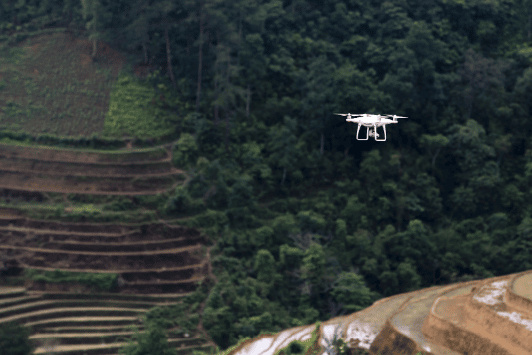
Hence, researchers put LiDAR on drones which gave birth to forest and agricultural drones. Drone services won’t miss out on this opportunity either and would offer to do this for farmers and foresters.
LiDAR technology was first developed in the early 1960s when engineers and land surveyors were producing maps. It wasn’t an acronym back then but a combination of “light” and “radar”. The LiDAR sensors were costly at that time and were exclusively used by planes. The problem with planes is they’re manually operated, expensive, and the results are inaccurate.

Source: Pexels
What is a LIDAR Drone?
By definition, a LiDAR drone can be any aerial drone that uses a LiDAR sensor attached to it. Because of recent innovations, the cost and size of LiDAR sensors have decreased. This increased the feasibility of LiDAR drones which made them more common. They’re also more accurate in data gathering than planes.
These also led to a rapid increase in companies producing LiDAR drones with a full-scale 3D-mapping system. A fixed-wing LiDAR drone can cover up to four square miles in one flight. This is currently the most accurate data currently achievable using any aerial surveying method.
It is important to note that different combinations of LiDAR sensors and drone models yield different results. For example, in places like sewer pipes and tunnels, LiDAR data may fail to create an accurate 3D render. It needs to be flown by a professional drone pilot to succeed in that case.
How LiDAR Drones Help in Forestry
Management and Agriculture
Source: Pexels
1. It Helps with Livestock Management
Regardless of location or size, the herd can be monitored effectively by drones. Livestock management is beginning to embrace drone technology for agriculture. Drones can be used to monitor livestock and pastures, to herd, and prevent rustling.
The aerial imagery from drones can help monitor livestock movement, like finding stray cattle and sheep. Coupled with thermal detectors, the drone sends data on sick or injured animals. The LiDAR drones save farmers so much time while increasing property awareness.
Farming is full of uncontrollable factors, like economics, disease, and weather to name a few. But drone technology is allowing farmers to make more accurate, data-driven decisions. Big tech giants have started drone services to help business people and reduce industry complexities. For farms that require a hand in drone technology, drone services are available. They have licensed drone pilots that can help farmers acquire the data they need.
2. Areal Imaging and LiDAR Sensors are Good For Plant Health Monitoring
Forests are dense and sometimes hard to traverse, making it difficult to track plant life. Especially when the weather is erratic, you expend double the energy and time checking on them. Not to mention, it’s also hazardous to do so, but such are occupational hazards.
However, we now have drones that can lend a helping hand through this task. Specifically, LiDAR drones with artificial intelligence have been advantageous in monitoring plant health. The sensors can help gather and process data regarding the well-being of trees, vegetation, and bushlands.
Using thermal and areal imagery, and topographic surveillance, they can locate diseased flora. They can also lead horticulturists and forest officials to those locations. And with the collected data, they can begin applying the proper treatment needed.
3. Forest and Land Stewardship Strategies
Organizations that manage vast forests can use LiDAR drones to gather data for their strategies. They can monitor the land and send you updates regularly. Excellent drone photography or a 3D-rendered version of the forest will allow them to make accurate decisions.
LiDAR drones can also send data regarding the health of your land so you can act immediately. If you need a layout of your property, a drone can bring you the data needed for a 3D map. The data is so accurate you can even create comprehensive maps of the place.
And because the drone will be scouting the area, you’ll also know which spots are prone to landslides. Hence, you can avoid accidents and ecological disease based on gathered, accurate data.
4. Watch Out for Forest Fires
Forest fires are common occurrences and it’s nearly impossible to eradicate them. There are as many causes as they are menacing and devastating. All we can do is prevent them from happening as much as possible with the right data and action.
Because drones are fast and precise, they can scan areas of a vast forest for potential threats of fires. The LiDAR sensors should be able to pick up these sources so you can act. These precautions will help prevent fires from starting and uncontrollably razing the forest. The forest ecosystem, animals, and plants will be safe from the danger caused by forest fires.
5. Save the Lives of Forest Officials and Other People
Forests are dangerous places and accidents can happen anytime so drones are used to help with rescue missions. Especially with search missions, drones can save lives, more so with LiDAR sensors.
Imagine letting out the drone for the usual wildlife monitoring and biodiversity checking. And then, it picks up a human heat signature that isn’t in a good spot. If they just got in an accident, they won’t have to wait until someone asks about their whereabouts. It was a completely random time but the drone essentially saved someone.
Drones are also efficient in delivering emergency medication or surveying harmful activities. Flying them saves so much time than operating on food that they can very well save a life.
Conclusion
With the advancement of technology come many conveniences and efficiencies in certain industries. In the case of agriculture and forestry management, LiDAR drones have made so many tasks much easier.
Be it monitoring livestock and flora, or strategizing land management, the drones will give you the data you need. They’ve been praised for their accurate data gathering that can be 3D printed. They can inform you in advance of any diseased plants and potential forest fires because of their LiDAR sensors.
Overall, it’s no exaggeration to say that drone technology is the future of agriculture and forestry management. Gone are the days when you frequently need to monitor everything on foot. The drones will do the menial tasks and you can act on any data that requires your attention.


2 Responses
Hi guys we run a agricultural drone and aerial mapping business if you ever want to collaborate on our technology to your members check out http://www.FalconUAV.com.au
LiDAR drone play important role in agriculture. nicely explained . Thanks for sharing.